Trip Report: |
We found this trailhead without too much
problem. Turn right just as you pass
the dam, and you'll find yourself at the
Day Use Area and the Trailhead for Timothy
Lake Trail 528. The sign says 13 miles
round-trip, but that is for hikers.
We didn't think anything of this at the
time...
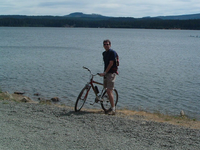
The weather was beautiful
and the sun shimmered off the crystal clear
lake as we pondered whether to eat lunch
before or after the ride. After some
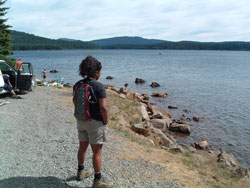 debating,
we headed down the smooth singletrack trail.
The trail was wide, with relatively few
roots. The trail mostly heads through
the woods, though you could see the lake
through the trees. Everything
was going along well, until we reached an
intersection with a sign telling us to dismount
our bikes for 600 feet. We did as instructed,
and walked across a couple of bridges.
At the end of the 600 feet, signs told us
that the remainder of the Pacific Crest
trail was closed to bikes and bikers had
to take the 1916 trail, diverging away from
the lake. We begrudgingly headed up
the 1916 trail, which was narrow and rocky,
nothing like the Timothy Lake Trail.
After a mile or so of continual uphill,
we reached a gravel road. debating,
we headed down the smooth singletrack trail.
The trail was wide, with relatively few
roots. The trail mostly heads through
the woods, though you could see the lake
through the trees. Everything
was going along well, until we reached an
intersection with a sign telling us to dismount
our bikes for 600 feet. We did as instructed,
and walked across a couple of bridges.
At the end of the 600 feet, signs told us
that the remainder of the Pacific Crest
trail was closed to bikes and bikers had
to take the 1916 trail, diverging away from
the lake. We begrudgingly headed up
the 1916 trail, which was narrow and rocky,
nothing like the Timothy Lake Trail.
After a mile or so of continual uphill,
we reached a gravel road.
A sign on the far side
of the road said "Timothy Lake Trail Left
1 Mile / FR42 Right 2 miles" To the
right was a rocky dirt road heading uphill,
and to the left was a nice gravel road heading
downhill. We followed the sign and
headed down the gravel road. Naturally,
this was the wrong way. THE SIGN IS
WRONG!! After blazing downhill for
a half-mile, and churning uphill for another
half-mile, we hit a paved road. We
turned right, and within another mile of
uphill, we found Forest Road 42, the main
road. The sign read "Timothy Lake
5 miles".
Unhappily, we pedalled
uphill for another couple of miles up the
road before it turned to a nice downhill
coast all the way to the lake. We
passed a couple of signs along the way for
various trails, but Sandra was cruising
way ahead of me, so I had to follow her
(my bike needed serviced). Eventually
we got to the campground and I lectured
her about staying together and threatened
to eat her lunch.
After eating lunch at
the day area, we drove back to the gravel
road to see where the real trail was, and
it was increasingly obvious that it went
up the rocky dirt road. We drove up
the dirt road until the trees hung too low
for our car-top bike rack. We 4x4'd
a bit to turn around, scratching up our
Infiniti 4x4 in the process (grr...).
We passed another group on the way out who
had also made the erroneious turn.
We steered them in the right direction.
Next time we'll get it right!!!
The part of this ride
that was on the trail was a lot of fun,
and not difficult at all. We're looking
forward to seeing what the rest of it is
like. The lake is beautiful, and even
though we missed half the trail, it was
a wonderful afternoon.
|