|
Ramona Falls
| Hiked: |
|
July, 2004 |
| Length: |
|
7.1 mile loop |
| Elevation Gain: |
|
1000 feet |
| USGS Quad: |
|
Bull Run Lake |
| GPS Coordinates: |
|
N: 45° 22' 47"
W: 121° 46' 33" |
| Photo Gallery: |
|
Ramona Falls Photos |

To Reach (From
Portland):
Take US-26 eastbound
toward Mt. Hood to Zigzag, across from the Mt. Hood Information Center,
you'll take a left onto Lolo Pass Road. Go 4.2 miles and turn right
onto Forest Road 1825. After 0.7 miles, turn right across
the Sandy River bridge, and continue 1.8 miles on FR-1825, where you'll
fork left onto Forest Road 100 for a half-mile. Find the gravel
parking area at road's end.
The Trail:
Note:
We have received a report
that the bridge over the Sandy has washed out. Make sure to
check with the Forest Service to see if the bridge is up before going.
The trail takes off from the gravel
parking area and takes you through primarily mountain hemlock forest,
following the Sandy River. At 1.2 miles, you'll reach a confusing
intersection. Follow the trail to the left and cross a footbridge
over the Sandy River. After rising up the other bank
of the river and re-entering the forest, you'll come to an intersection
where you'll have to fill out a mandatory wilderness permit before continuing.
You can go either way from here, as
it is a loop, but we suggest taking the more scenic trail to the left.
You'll cross another creek and wind your way through a pine forest before
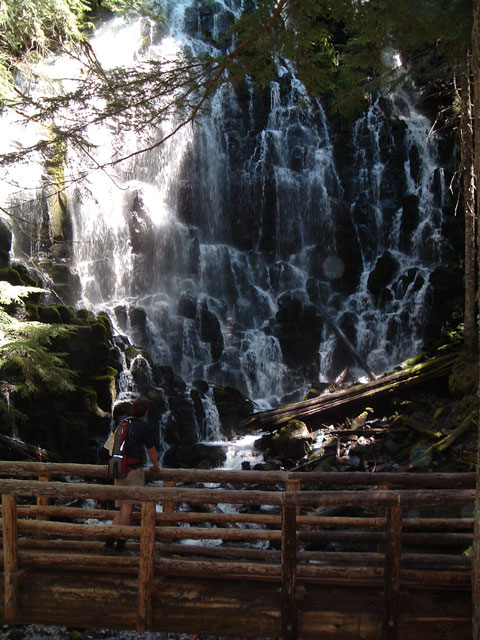
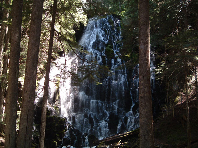
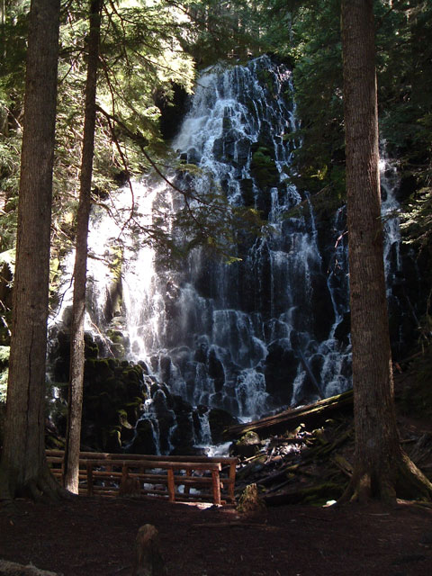
following Ramona Creek. Just around the bend, you'll find fantastic
Ramona Falls, perhaps the most beautiful waterfall in Oregon.
Ramona Falls cascades like a wonderland over the wide, rock lip as you
sit at the base and gaze at it's beauty. You can camp here, as long
as you stay 500 feet away from the falls. There isn't much sunlight
in this area, so you may want to bring a sweater if you are planning to
stay at the falls for lunch.
From here, you can take the Timberline
Trail around Yocum Ridge to Bald Mountain (which adds 6.1 miles to the
loop), or continue along the loop back to your car.
Our Take:
This is a must-see trail. Although
the trail itself is pretty representative of mountain Northwest hiking,
with lodgpole pines, mountain hemlock, creeks, and rivers, the real prize
is the falls itself. We were amazed when we saw it. It's cascade
is quite different from the much taller falls of the Columbia River Gorge.
We ate lunch at the bottom of the falls,
which got cold quickly with the cool mist of the falls combined with total
lack of sunlight. The trail itself is fairly flat and easy, which
makes this a very popular hike. We thought about backpacking in
here the previous weekend, but it rained hard all weekend, so we wimped
out.
Photo Gallery
(Click for Larger Image)
Related Sites
|